Looks like La Niña is planning to hang around this winter ... again.
La Niña weather conditions, the cool phase of the El Niño-Southern Oscillation (ENSO) climate pattern, is heading into itsthird consecutive winterwith a91% chance of La Niñathrough September-November and an 80% chance through the early winter (November-January), saysClimate.gov. This rare occurrence has only happened twice in the past 70 years.
What does this mean for global commodity production?
Gro Intelligencesays La Niña conditions for a third year in a row could have far-reaching effects on global agriculture by triggering large shifts in weather.
La Niña tends to create drought and dry conditions in many parts of the world, including Brazil, Argentina and the U.S., while bringing additional precipitation to other areas, such as Australia.
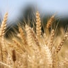
- Argentinaimpacts could include reduced wheat acreage planted, hindering the crop's yield development; La Niña previously caused substantial soybean losses in Argentina during the 2020/21 and 2021/22 seasons
- Brazilcorn and soybeans could decrease; Brazil's southern states experienced severe drought this past year
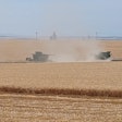
- U.S.hard red winter wheatalso suffered from dry conditionsbrought on by La Niña
- Australiais looking at itsthird year of strong wheat productionin 2022 as good weather boosts planting across its grain belt
When will La Niña transition to neutral?
La Niña’scharacteristic tropical atmospheric response— more rain and clouds over Indonesia, less over the central Pacific, and stronger-than-average winds both aloft and near the surface — was active in August, notes Climate.gov. Taken together, the oceanic and atmospheric conditions tell us that La Niña is solidly in place.
There is a lot of uncertainty about how long this La Niña will last and when we will see a transition to neutral conditions.
Current forecaster consensus gives La Niña the edge through January-March (54%), with a 56% chance of neutral for the February-April period.
Why should I care?
La Niña and El Niño affectglobal atmospheric circulation patternsin somewhat usual patterns, altering jet streams and storm tracks around the world and influencing temperature, rain/snow and tropical cyclone seasons -- which helps us predict climate patterns to come.
Here are some examples of what La Niña likes to bring to the U.S.:
- An increase Atlantic hurricane season activity
- Drier winters through the southern tier of the U.S., increasing干旱条件下
- Wetter (and snowier) conditions for parts of thenorthern tier of the U.S.
- Hotter, drier summers in Texasfollowing La Niña winters
- More frequent spring hailstorms and tornadoesin the south-central U.S.
- Reduced number ofatmospheric riversimpacting the West Coast
La Niña year does not guarantee a bad year with regards to corn and soybean yields, but it alsomeans not a ‘really good year.’
Globally, La Niña can reducecrop yields, which given the challenges, disruptions and turmoil in the past year is yet another threat to our global food supply and system.
Additional reading:


