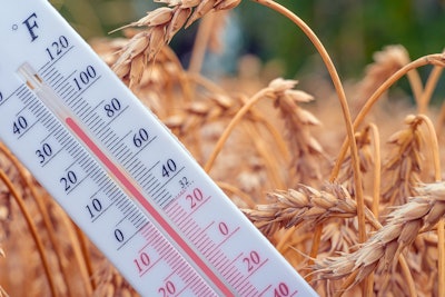
El Niño may be back by the end of 2023, and it's bringing warmer temperatures with it.
Climate models suggest that afterthree years of the La Niña weather pattern, which generally lowers global temperatures, the world will experience a return to El Niño, the warmer counterpart, later this year.
And according toreports, climate scientists say the earth could reach a new average temperature record in 2023 or 2024, fueled by climate change and the El Niño weather pattern.
Friederike Otto, senior lecturer at Imperial College London's Grantham Institute, said El Nino-fueled temperatures could worsen the climate change impacts countries are already experiencing, including severe heatwaves, drought and wildfires.
What is El Niño?
El Niño is the warm phase of the El Niño-Southern Oscillation (ENSO) and is associated with a band of warm ocean water that develops in the central and east-central equatorial Pacific.
During El Niño, winds blowing west along the equator slow down, and warm water is pushed east, creating warmer surface ocean temperatures, increasing precipitation significantly.
Conversely, El Niño conditions frequently bring drier, warmer winters to the northern parts of the continental U.S. Specifically in the Pacific Northwest, an El Niño tends to favor a warmer winter and lower-than-average precipitation.
According toClimate.gov, conditions are favorable for the development of El Niño conditions within the next six months. TheNational Weather Servicesays there’s a 62% chance of El Niño conditions for the May-July period and more than an 80% chance of El Niño by the fall.
On average, this weather pattern occurs every two to seven years and can last up to 18 months. During El Niño episodes, normal patterns of tropical precipitation and atmospheric circulation are disrupted, triggering extreme climate events around the globe.
What does this mean for U.S. agriculture?
Globally, El Niño shifts the growing season around the tropics, causes winter drought in Africa and South America, and changes the timing of monsoon rainfalls in Asia.
In the U.S., El Niño-related temperature and precipitation impacts occur during the cold half of the year (October through March). Typically wetter-than-average conditions occur along the Gulf Coast from Texas to Florida during this six-month period, saysClimate.gov.
The new weather pattern could bring relief to the winter wheat belt in the Great Plains, according to aGro Intelligenceanalysis of past La Niña and El Niño transitions.
La Niña’s passing could help U.S. winter wheat crops during the 2023/24 year. Similar weather conditions in 2018 and 2019 brought above-normal precipitation to at least parts of the Great Plains. And 2015’s El Niño resulted in soil moisture levels that were normal or above normal.
Other crop impacts from El Niño:
- Corn yields are usually lower than historic averages
- Harvests of summer crops such as corn and cotton may be delayed because of increased rains in the fall
- Frequent rains may reduce tilling and yield of winter wheat
- Wheat yields in southern Alabama and Georgia are generally higher than average during El Niño
- Frequent rains at the end of August and in early September may increase Hessian fly populations on winter wheat
- Fungal and bacterial diseases present higher risks
- Winter pasture crops may benefit from wetter weather, but planting and harvesting operations may be affected by heavy rainfall


